Mid Norway Pressure Study 2nd Edition

Introduction

Recently updated, this offshore Mid Norway pressure study combines our extensive experience of overpressures in Mid Norway and elsewhere, with IHS’s comprehensive, quality database, to examine the distribution and impact of overpressure on this region’s petroleum system.

The study has already been purchased by many operators in the area, as it provides key information on:

  • The timing of pressure development and its influence on hydrocarbon trapping and
  • Assessing and reducing risk associated with the highly variable pressure and water depths in the region

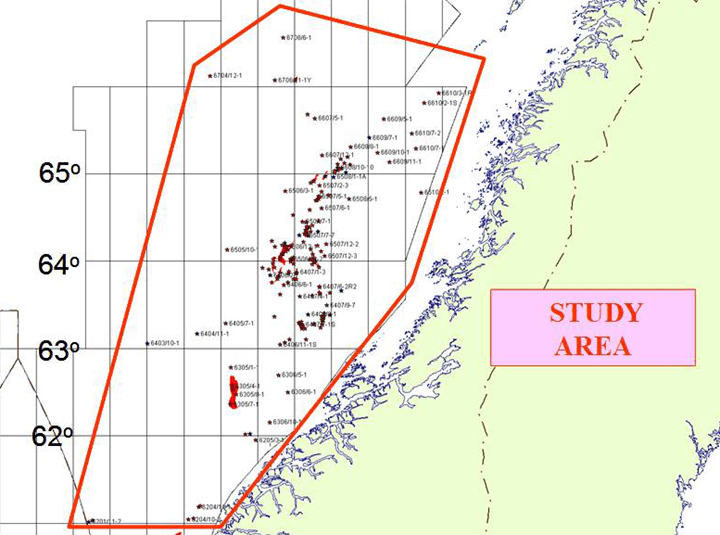
The Mid Norway study utilises over 197 wells out of a possible 225 wells*, providing a comprehensive and authoritative picture of formation pressure distribution, and its causes within the region. This gives an invaluable calibration to in-house pressure interpretations, resulting in a highly detailed look at many facets of Mid Norway pressure.

*At the time of the study

Partners

  • Partners
Benefits

If your company has exploration, development and/or production interests in the Mid Norway you will benefit with:

  • Reduced risk of experiencing unexpectedly high or low pressures
  • Associated time and cost savings
  • Identification of additional reserves
  • Improved understanding of the regional pressure regime
  • The dramatic contrasts in pressure regimes found in Jurassic/Triassic reservoirs explained
  • See how the influence of glacial loading/unloading is related to seal breach and non-equilibrated fluids in some hydrocarbon fields
Deliverables
  • A complete description of subsurface pressures, backed by selected single-well pressure-depth plots, and many multi-well plots by horizon and location
  • The distribution of overpressure, mapped out at 7 main horizons (Post Palaeocene (Brygge), Palaeocene (Tang and Tare), Upper Cretaceous (Springar, Nise and Kvitnos), Lower Cretaceous (Lysing, Lange and Lyr), Upper Jurassic (Spekke and Melke), Lower/Middle Jurassic (Garn, Ile, Tilje and Are) and Triassic) and displayed on a series of map enclosures, coupled with maps of residual overpressures generated between the Lange Formation and the Lower/Middle Jurassic reservoirs and between the Garn, Ile, Tilje and Are Formations
  • A composite structure map of tectonic elements, based on a wide search of published data, integrated with all available pressure data to produce overpressure compartment maps
  • Four case studies, dealing with topics such as – lithostatic and fracture gradients, seal breach risking, pressure reversals and field scale studies, which illustrate the main characteristics of overpressure in Mid Norway
  • The study is available hard-bound in A4 format (with enclosures) and GIS Shape files on CD
  • A presentation of the summary and conclusions from the final technical review is also on CD

By submitting this form, you are consenting to receive marketing emails from: Ikon Science, 1 The Crescent, Surbiton, Greater London, KT6 4BN United Kingdom, https://www.ikonscience.com/. You can revoke your consent to receive emails at any time by using the SafeUnsubscribe SafeUnsubscribe® link, found at the bottom of every email.